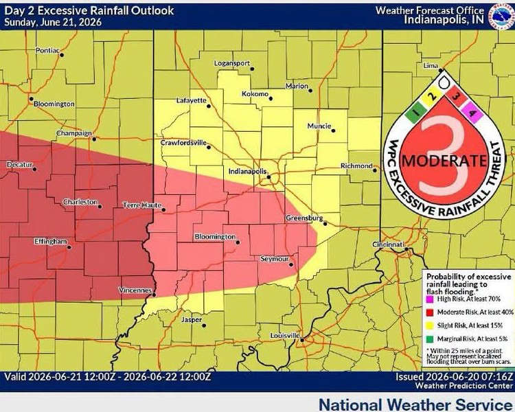
SOUTH-CENTRAL, Ind. - The National Weather Service (NWS) has announced that south-central Indiana is included in the area that has potential for severe weather from late Sunday afternoon through Monday morning. An NWS Flood Watch has also been issued for the region.
Portions of Bartholomew, Johnson, Jackson, Jennings, Brown, Shelby, Decatur, and Morgan Counties are under a "Marginal" risk (1/5) for severe weather and a "Moderate" risk (3/4) for excessive rainfall and flash flooding during the time period.
Several rounds of showers and thunderstorms are expected from Sunday afternoon through Sunday night/early Monday morning, with damaging winds and isolated tornadoes as the primary threats.
The heavy rain (1 to 3 inches predicted) could lead to flooding concerns, hence the Flood Watch.
 Flood Watch issued for local counties
 North Vernon Police bust Indy man for meth dealing, possession
 ISP arrests Kentucky man for Attempted Murder for alleged I-65 road rage shooting
 Gov. Braun declares State of Disaster Emergency, opens relief fund for individuals
 Two counties get reprieve from summer gas price hike